UNIONVILLE MUSEUM
  • Home
  • About
    • Location, Hours and Tours
    • Board of Directors
  • Collection
    • Our Collection
    • Flood of '55
  • Museum Store
  • History
    • History of Unionville
    • Unionville Stories
    • History of Our Building
  • Support
    • Legacy Fund
    • Become a Member
    • Become a Volunteer
    • Donate to General Fund
  • Partners
  • Contact
  • Prints
  • >
  • 1878 Bird's eye View Map of Unionville - Print Only

1878 Bird's eye View Map of Unionville - Print Only

SKU:
$30.00
$30.00
Unavailable
per item

FREE SHIPPING! Item is rolled and shipped in a tube.


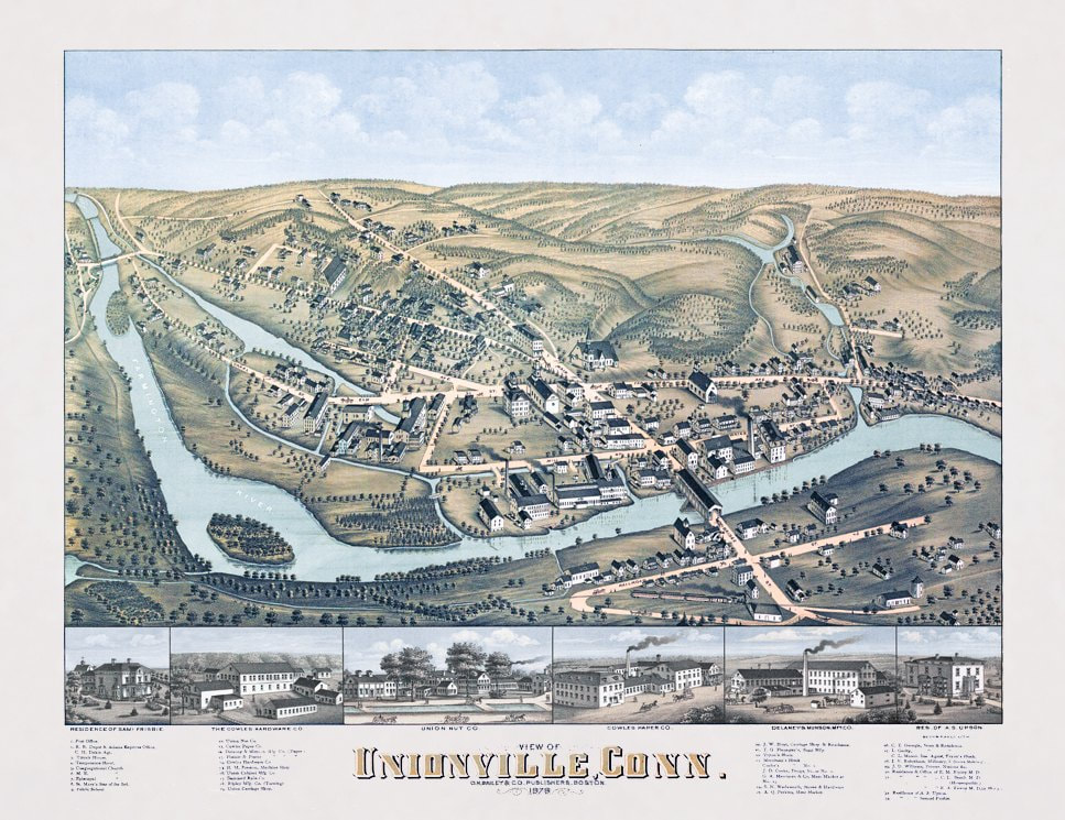
This is a print of a beautifully illustrated map, originally published by O.H. Bailey in 1878. It's a bird's eye view of Unionville at a time when the South Main Street bridge was a covered wooden bridge. And a time when there were several manufacturing companies in the village their commerce made possible by a web of feeder canals that connected them to the Farmington River. Note the expanses of undeveloped land, something you don't see today.

Add to Cart
Picture
Unionville Museum
15 School Street,
​Unionville, CT 06085
(860) 673-2231

​

FREE ADMISSION​​
Open Wednesdays, Saturdays and Sundays 
2 to 4 p.m. during exhibits​

  • Home
  • About
    • Location, Hours and Tours
    • Board of Directors
  • Collection
    • Our Collection
    • Flood of '55
  • Museum Store
  • History
    • History of Unionville
    • Unionville Stories
    • History of Our Building
  • Support
    • Legacy Fund
    • Become a Member
    • Become a Volunteer
    • Donate to General Fund
  • Partners
  • Contact